Scientists with the U.S. Geological Survey (USGS) and affiliated observatories have elevated their monitoring of three active volcanoes in the United States: Great Sitkin Volcano and Mount Spurr in Alaska, and Kīlauea Volcano in Hawaii. These updates come in response to increased seismic activity, gas emissions, and signs of magma movement, all of which may indicate future eruptive activity.
Although none of the volcanoes are currently erupting as of the most recent official bulletins, experts are emphasizing the importance of continued public awareness and emergency preparedness in nearby communities.
Volcano Alert Levels: Understanding the Current Status
The USGS Volcano Alert Level System provides four stages: Normal, Advisory, Watch, and Warning. These levels are paired with color codes used in aviation (Green, Yellow, Orange, Red).
As of the latest reports:
- Great Sitkin Volcano is at Alert Level: Watch and Aviation Color Code: Orange
(*Source: Alaska Volcano Observatory – AVO) - Mount Spurr is at Alert Level: Advisory, with increased seismic unrest
(*Source: AVO Monitoring Summary) - Kīlauea Volcano is currently at Alert Level: Advisory
(*Source: USGS Hawaiian Volcano Observatory)
These alert levels do not indicate an ongoing eruption, but they reflect heightened unrest and the potential for rapid changes.

Increased Seismic Activity: A Key Indicator
According to data published by the USGS, earthquake swarms beneath Great Sitkin and Mount Spurr have intensified over recent months. These swarms typically signal magma movement within the volcano’s plumbing system.
For Mount Spurr, located about 120 kilometers west of Anchorage, weekly earthquake counts have increased significantly, prompting the Alaska Volcano Observatory to conduct more detailed seismic and geodetic analyses.
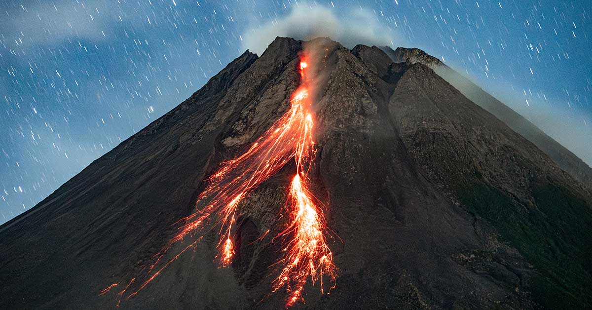
Kīlauea Volcano, located on Hawaii’s Big Island, last erupted in February 2024 within the Halemaʻumaʻu crater. The eruption was confined to Hawaii Volcanoes National Park and posed no threat to residential areas. However, minor tremor activity continues, and HVO scientists continue to monitor for any further signs of unrest.

What Magma Movement Means for Nearby Communities
When magma accumulates underground, it can increase volcanic pressure, leading to ground deformation, earthquakes, and potentially gas emissions. These are typical precursors to volcanic eruptions.
Communities near Great Sitkin, Mount Spurr, and Kīlauea are advised to:
- Follow updates from USGS, AVO, and HVO
- Understand local emergency response plans
- Prepare evacuation kits and stay informed via local authorities
While no evacuations are currently underway, local and federal agencies encourage vigilance.
(*Sources: USGS Volcano Hazards Program, FEMA)

From Dormant to Active: The Volcanic Cycle
Volcanoes can remain quiet for decades or centuries before entering active phases. For example:
- Mount Spurr last erupted in 1992, producing significant ashfall over parts of southern Alaska.
- Great Sitkin’s most recent activity began in 2021 and has continued with low-level eruptions observed as recently as 2023.
- Kīlauea is one of the world’s most active volcanoes, with multiple eruptions since 1983, including major events in 2018 and intermittent activity through 2024.
These events provide valuable historical data that scientists use to compare against current signs of unrest.
(*Sources: USGS Eruption History Database)

Monitoring Tools: How Scientists Predict Volcanic Activity
Volcanologists rely on a wide array of advanced monitoring systems to track changes beneath and around volcanoes:
- Seismometers record earthquake frequency and depth
- Tiltmeters and GPS measure ground deformation
- Gas spectrometers monitor volcanic gases such as SO₂ and CO₂
- Thermal satellite imagery tracks changes in surface temperature and lava flow activity
By analyzing this data, scientists develop eruption models to help public officials make timely decisions.
(*Source: USGS Volcano Monitoring Techniques)

Potential Impact Zones: What Areas Are at Risk?
Each volcano presents unique risks based on geography and population:
- Great Sitkin is located in the Aleutian Islands, where eruptions could disrupt air traffic and maritime operations due to ash emissions.
- Mount Spurr, due to its proximity to Anchorage, Alaska’s largest city, could produce ash clouds that impact air quality, transportation, and infrastructure.
- Kīlauea, situated within Hawaii Volcanoes National Park, could produce lava flows and volcanic gases that affect nearby communities, although eruptions are generally confined to the park.
Emergency officials work with USGS and state geologists to continuously assess these zones and update preparedness plans accordingly.
(*Sources: Alaska Division of Geological & Geophysical Surveys, Hawaii Emergency Management Agency)

What Happens If an Eruption Occurs?
Should any of these volcanoes erupt, the impacts could range from:
- Volcanic ash fallout, affecting aviation and human health
- Lava flows, potentially damaging property or infrastructure
- Gas emissions, such as sulfur dioxide, which can cause air quality concerns
- Lahar flows or landslides, particularly in Alaska’s volcanic terrain
The USGS coordinates with local emergency services to issue alerts and evacuation recommendations if necessary.
(*Source: USGS Volcano Hazards Planning Guide)

Conclusion: Be Informed, Not Alarmed
While the elevated seismic activity and volcanic unrest at Great Sitkin, Mount Spurr, and Kīlauea are being taken seriously by scientists, no eruption is currently in progress as of the latest updates from the USGS.
The increased monitoring and elevated alert levels are precautionary and based on standard scientific protocols. The public is encouraged to stay informed through official government sources, avoid spreading unverified claims, and understand how to respond appropriately in the event of an emergency.
Trusted Sources and Official Resources:
- USGS Volcano Hazards Program
- Alaska Volcano Observatory (AVO)
- Hawaiian Volcano Observatory (HVO)
- Federal Emergency Management Agency (FEMA)
- National Park Service – Hawaii Volcanoes National Park